If you are looking for an activity in Tenerife with which to disconnect from the stress of everyday life and at the same time connect with nature, the trails of the Anaga Rural Park may be the perfect activity.
In Senda we tell you everything you need to know of this Biosphere Reserve, including the best trails in Anaga.
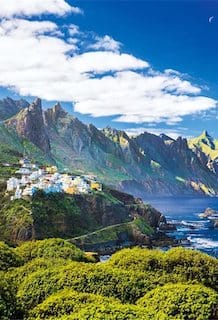
In the north-east of the island, just a couple of minutes from the city of Santa Cruz de Tenerife and San Cristóbal de La Laguna, we find this natural landscape, declared a Biosphere Reserve for its special and exceptional value.
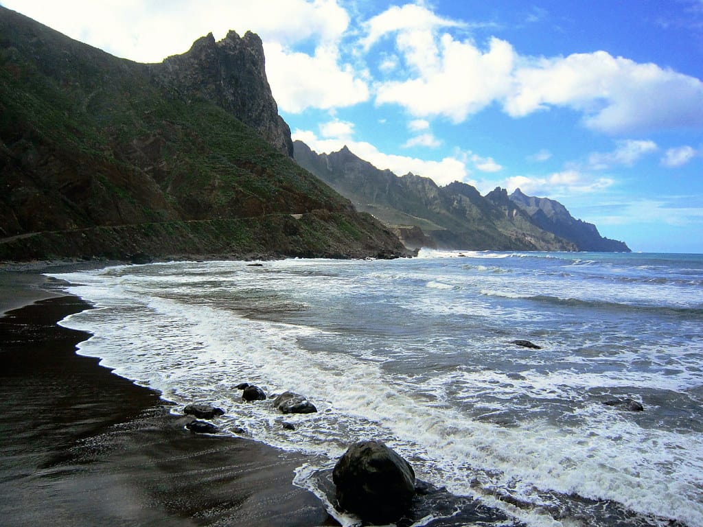
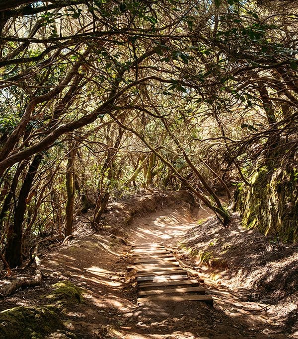
Its trails are the ideal way to discover this enchanting massif. Anaga hides Laurisilva forestsand unique views from its viewpoints of valleys and ravines that lead to magnificent black sand beaches.
Anaga Rural Park
The rural park of Anaga is a protected natural area located in the Anaga Massif. highest concentration of endemisms per square kilometre of the entire Europe and was declared a Biosphere Reserve on 9 June 2015.
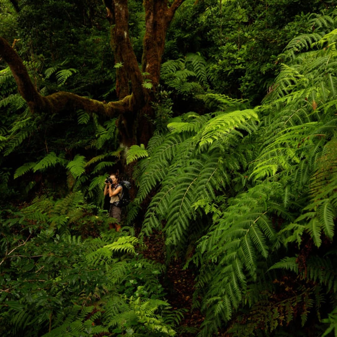
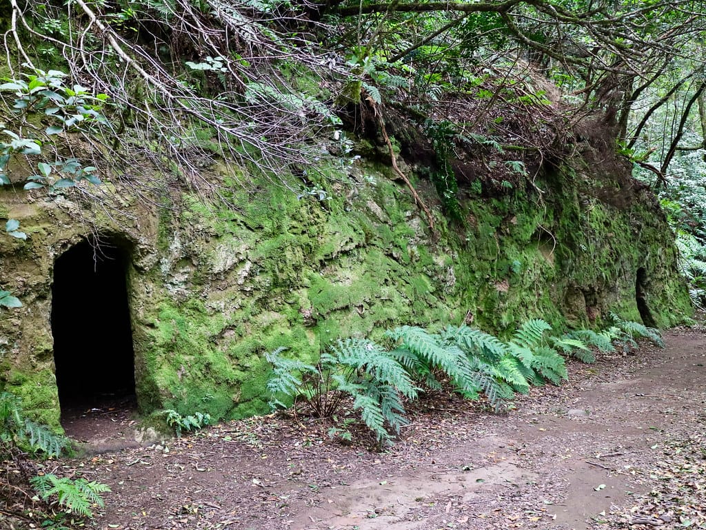
With a total surface area of 48,727 hectares, of which 15,489 correspond to the terrestrial environment and 33,238 to the marine environment, it is home to forests from the tertiary era of Laurisilva, typical of the Canary Islands, Madeira and the Azores.
Next, in this article we recommend the best route options by categories so that you can enjoy this unique experience in the best way according to your preferences.
Best routes in Anaga【Without permissions】
Route from Draguillo to Roque Beach
Level: Bass
Approximate duration: 2 hours and 30 minutes
Distance: 4.6 kilometres
Route of the route: It starts in El Draguillo, goes through Barranco de Guaguay, Benijo, Playa de Benijo, Playa de Almáciga, Almáciga and ends at Playa del Roque de las Bodegas.
Notes of interest: Following part of the old coastal path you can visit the three most famous beaches of the Anaga massif: Roque de las Bodegas, Almáciga and Benijo.
Route from Cruz del Carmen to Punta de Hidalgo
Level: Medium
Approximate duration: 5 hours
Distance: 11.8 km
Route of the route: The trail starts at Cruz del Carmen (TF-12 road) and passes through Batán de Arriba, Batán de Abajo, Bejía, El Morro, Homicián until it reaches Punta de Hidalgo through the Himicián neighbourhood.
Notes of interest: It is a trail that descends from the summit to sea level, although it passes through two high ascents at El Batán and El Morro volcano. It ends in a steep asphalt slope.
Route from Bailadero to Taganana
Level: Medium-High
Approximate duration: 2 hours
Distance: 3.3 km
Route of the route: The path starts at El Bailadero, then goes down Roque del Valle, crosses the TF-134 road, crosses the road and approaches Roque de Amogoje.
It then crosses the road twice until it reaches the Azanos neighbourhood, where it takes the turn-off to Lomo los Lirios and ends at the Plaza de Las Nieves in Taganana.
Notes of interest: It is a path with a descent from the pass of El Bailadero to Taganana along an old path that connected this village with San Andrés.
It crosses the road three times and part of the path is on the road, so extreme caution should be taken and walk on the hard shoulder. It is advisable to wear reflective clothing.
Circular route in Chamorga
Level: High
Approximate duration: 7 hours and 30 minutes
Distance: 12 km
Route of the route: Circular path that starts in Chamorga, continues descending through Casas Blancas, Roque Bermejo, Faro de Anaga, Fuente del Junquillo, Las Palmas de Anaga to El Draguillo.
From this point go up Cruz del Draguillo and return to Caserío de Chamorga.
Notes of interest: This is a circular path in Anaga with continuous descents and descents. It runs through a very worn-out area and crosses many ravines, which means that it can be affected by landslides relatively often.
Which plan to follow on your holidays?
Don't miss the Experience Parque Rural de Anaga: Hiking and Guachinche
Visit the Anaga Rural Park. Enjoy a unique forest and ends this experience in a Guachinche tasting typical Canarian dishes.
If you want to live a unique and environmentally friendly experience, and also get to know the Anaga Rural Park, Biosphere Reserve, with the help of a local guide, book your place on a guided visit to an ancient forest.
Best routes in Anaga【With permissions】
Circular route of the Enchanted Forest or Path of El Pijaral
Level: Under
Approximate duration: 3 hours
Distance: 7 km
Route of the route: Sendero Anaga Bosque Encantado is a circular trail that starts in Zona de La Ensillada (TF-123 at kilometre point 4-5) and follows the El Pijaral trail.
Go past Roque Anambro to Mirador del Tejo, where the Pista Cabezo del Tejo starts on the right, the way back.
Notes of interest: It runs through protected areas, is not continuously maintained, and certain sections may not be in good condition.
The authorisation of the reserve may be withdrawn in the event of adverse weather conditions or situations of high risk of forest fire.
We recommend that you inform yourself of possible states of alert declared by the authorities.
Before you go on the trail you must reserve a permit
Monte de Aguirre circular route
Level: Medium
Approximate duration: 3 hours and 15 minutes
Distance: 6.2 km
Route of the route: Circular path in Anaga that starts in Cruz de Afur, crossing the road there is a path (not signposted) that descends to La Asomada, we will arrive at the Anaga Forest House.
You turn back but instead of heading towards Jardina, take the other path through the vegetation, crossing the areas of La Tosquerlla and Hoya de Piedra charca until you reach Cuatro caminos, where you follow the Sendero PR TF2 Pico del inglés and Carretera TF114 until you reach Cruz Afur.
Notes of interest: There are areas where you will have to walk crouching down because of the vegetation that covers the path, but it is not difficult.
Before you go on the trail you must reserve a permit
Best adapted path
Route of the Senses
Level: Under
Wheelchair accessible.
Adapted for people with motor or sensory disabilities.
Approximate duration: 10 minutes
Distance: 0.34 km
Route of the route: The Los Sentidos de Anaga trail begins in Cruz del Carmen, from where 3 routes start, where experiences through smell, sight and touch await you to discover elements of the environment.
Along the route there are panels with sensory signs to smell, touch or look at different elements.
Path 1 is equipped with a walkway adapted for wheelchairs.
Notes of interest: consult the state of the path according to weather conditions.
Best trail for children
Forest of Enigmas Route
Level: Under
Approximate duration: 1 hour and 20 minutes
Distance: 5 km
Route of the route: A circular trail in Anaga for children, ideal for the whole family, which runs through the Bosque de Los Enigmas.
Start at Mirador Cruz del Carmen (parking spaces available).
The route is perfectly signposted thanks to 7 posts that guide the way until it ends back at Cruz del Carmen.
Notes of interest: There are some steep sections, so to avoid slipping it is advisable to wear suitable footwear.
It is advisable to take some warm clothes, even if it is summer, Anaga is very humid.
If you're interested in trails, you can't miss the wonderful trails on the Teide
One comment
Pingback:
Anaga: Tenerife's Enchanted Forest