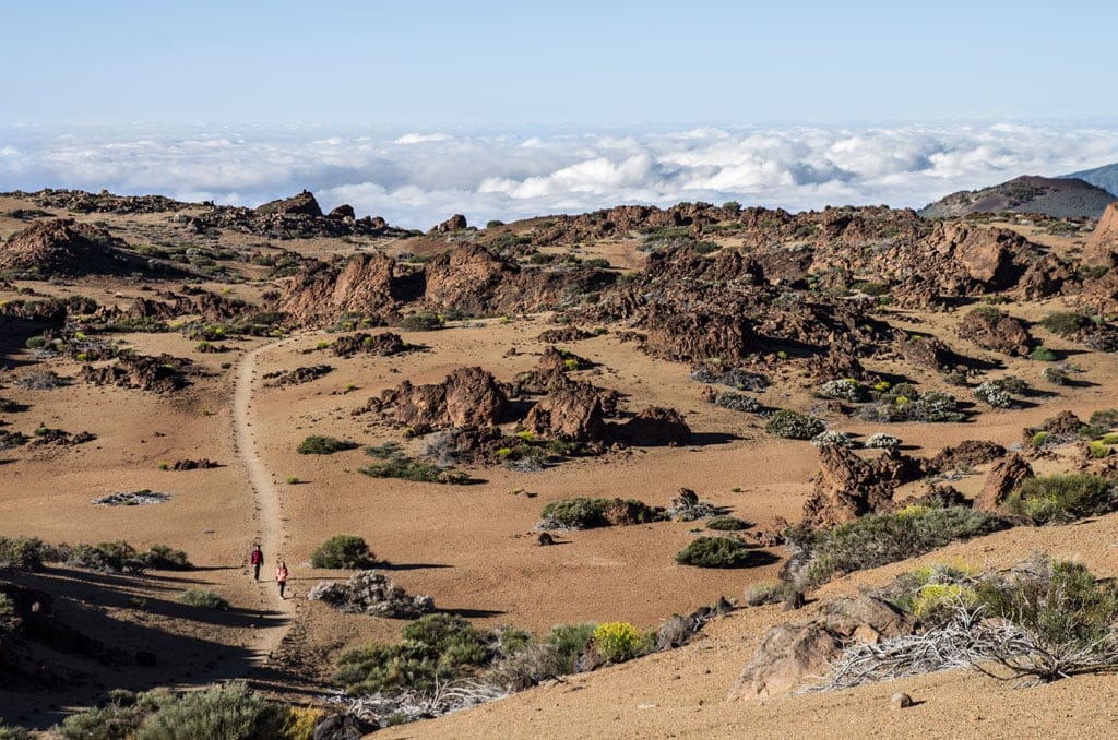
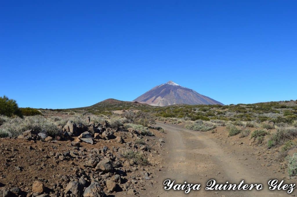
Undoubtedly, the Teide National Park is the place that most identifies Tenerife.not only for being declared a Unesco World Heritage Site in 2007 with the status of a natural propertyThe enjoyment it will transmit to you at all times, through its sublime landscapes, which will seem to you to be from another planet:
The possibility of breathing the fresh air of the highest peak in Spain; and the feeling of walking among volcanic lava.
If you are a lover of adventuring in new places, do not hesitate to read this post, as it will provide you with all the key information, so that you have a previous knowledge, before you start your adventure. discover the 41 most spectacular trails in Teide National Park.
It should also be noted that, if you wish to live a unique and incomparable experience, these are more than enough reasons for you not to think twice and enter this majestic National Park.
Consequently, What are you waiting for to discover and explore these paradisiacal routes?
The history and facts to consider of the Teide National Park
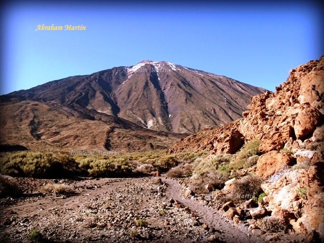
As is well known, the Teide National Parkwhose The area is almost 19,000 hectaresis located in the centre of the island of Chicharras, at a distance of average altitude of 2,000 metres, y its summit represents the highest peak in Spain, at 3,718 metres..
It has a wealth of fauna and floraThe park is home to a great diversity of endemic Canarian species and species exclusive to the park.
It is also worth mentioning that the Teide National Park offers a wide range of activities to do, such as, for example:
StargazingThis is an ideal experience for anyone who likes to contemplate the night sky, enjoy the stars from Las Cañadas del Teide and observe the stars in the best possible conditions.
And also, trailsThe park administration offers you guided and self-guided routes, with the aim of resolving any doubts that may arise, as well as making your stay in the park as pleasant as possible.

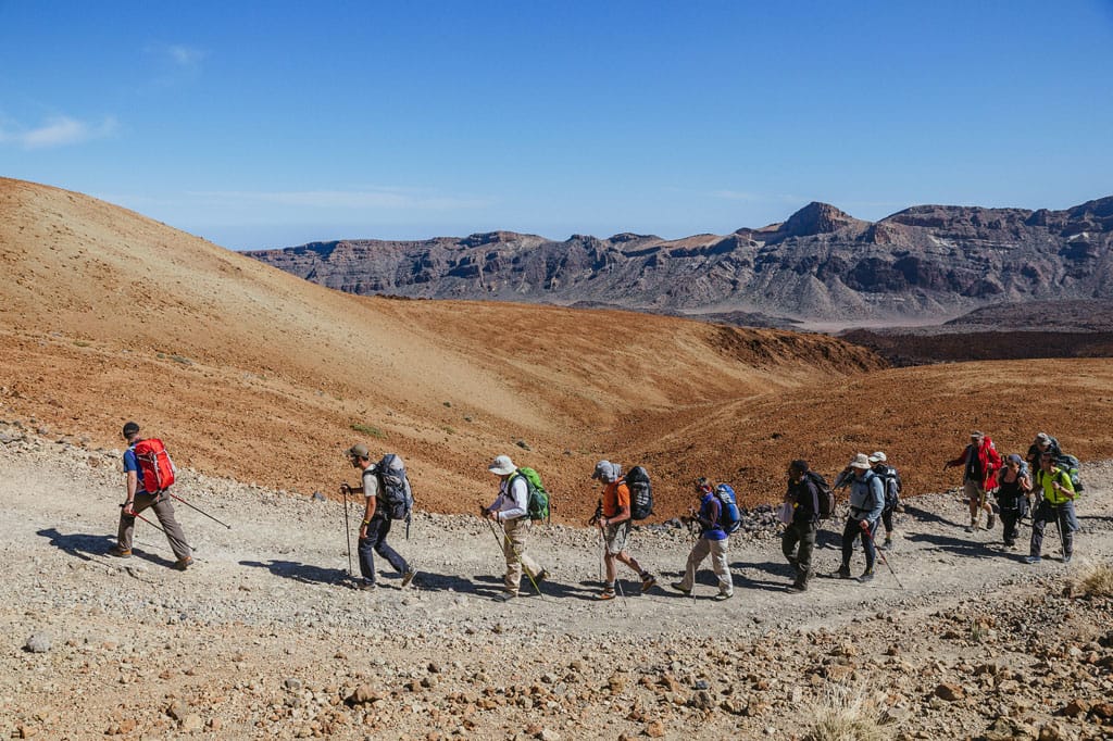
The 41 most spectacular trails in the Teide National Park
Subsequently, we provide you with a list with information on the 41 sublime trails that you can do in the majestic Teide National Parkin addition to a topographical map in which you will see most of these routes reflected. Without a doubt, you can't miss them, or you'll regret it.

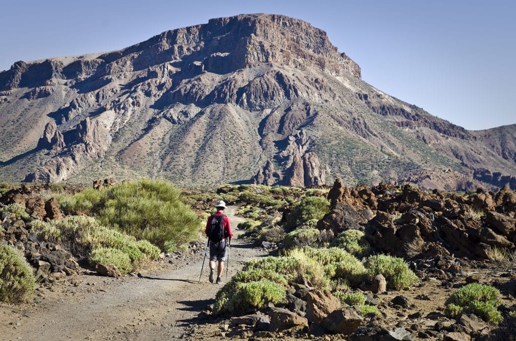
Fortress Trail
The Fortress Path starts at the El Portillo Visitor Centre and ends at the Cuesta de La Fortaleza (border of the National Park).
This route has a duration approximately 1 hour 45 minutes, in a linear state, covering a length of 5.5 km.
Referring to its difficultyIt is important to know that it is low, without risk. And this one has a maximum gradient of 175 metres downhill.
It also has connections with footpaths 2, 4 6, 22, 24, 25, 29, 33 and GR TF131.

Through this trail, you will have the opportunity to appreciate flora and faunasuch as: the shrike and pimelia which are abundant, as well as more features of the park.
Black Sands Trail
The Black Sands Trail starts and ends at the El Portillo Visitor Centre.
It has a duration of exactly 3 hours (circuit), covering a length of 6 km.
With regard to its difficultyIt should be noted that it is low, although attention must be paid, as there is a steep section. This path has a maximum gradient of 257 metres.
In turn, it has connections with footpaths 1, 4, 37 and GR 131 (the old Camino Real de Chasna).

It should be noted that this route offers a spectacular panoramic view of the National Park.as well as Llano de Maja.
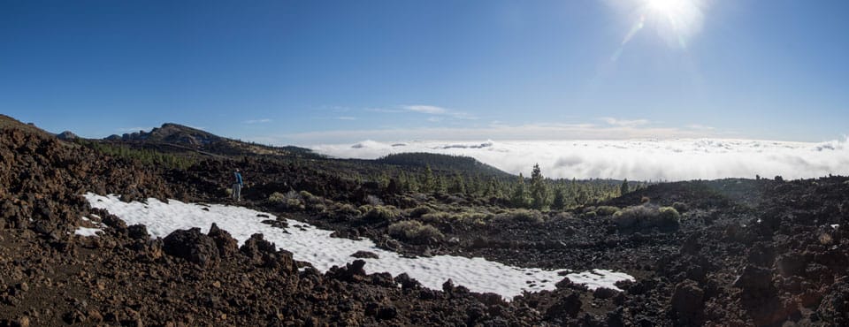
It is also a fantastic place to see the action of the sea of clouds brought by the trade winds over the Orotava Valley, and also to observe the island of La Palma.
The flora The most common part of this route consists of the broom, the laburnum, the rose bush at the summitetc. And as for the faunayou will be able to observe kestrels, mosquito netsamong others.
Roques de García Trail
The Roques de García Trail begins and ends at the Mirador de La Ruleta.
It has a duration 2 hours (circuit), with a length of 3.6 km.
With regard to their level of difficultyThis is an average walk, as there is a steep uphill section at the end of the path, if it is done in an anti-clockwise direction. It has a maximum gradient of 167 metres.
This trail covers connections with others, such as 23 and 26.

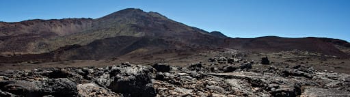
Through this trail, we will have the possibility to observe the authenticity of the volcanic rocks.
The flora that we can find on this route is very diverse and representative of Las Cañadas, such as: broom, broomcorns, codleaf, straw grasses and wattles.
Siete Cañadas Trail
The Siete Cañadas Trail starts at the El Portillo Visitor Centre and ends at the Cañada Blanca Visitor Centre.
Your duration is about 4 - 5 hours, covering a length of 16.6 km.
In terms of its difficulty is low. And it has a maximum height difference of 169 metres.
It should be noted that this route has connections with footpaths 1, 2, 5, 16 and GR 131 (the old Camino Real de Chasna).

It is useful to know that, since pre-Hispanic times, this path was used to cross the island from north to south..
Along the route we also find the remains of shepherds' shelters and majestic views of Mount Teide.
The flora The most common is the spicy tajinaste with a beautiful blue blossom in June.
Path of Degollada de Guajara
The Degollada de Guajara Trail starts at the Siete Cañadas path (nº4), and ends at Degollada de Guajara.
It has a total duration of 1 hour, with a length of 1.3 km.
Its level of difficulty is high. It has a maximum height difference of 205 metres.
There is connections with other footpaths, such as the 4, 8, 15 and GR 131 (the old Camino Real de Chasna).

It should be noted that the observation from La Degollada is majesticwith wide views of the Teide National Park and the southern slopes of the island.
Los Tomillos Mountain Trail
The Tomillos Mountain Trail starts at the Fortaleza trail (nº1) and ends at the Montaña Blanca trail (nº7).
Your duration is 2 hours 30 minutes, thus covering a total length of 5.2 km.
The difficulty of this is medium. It has a maximum ascent of 473 metres.
This route has connections with paths 1, 7, 22, 24 and 27.

It should be noted that this route has a certain historical valueIt was the ancient path used by the first explorers and the sulphur and iron collectors on their continuous ascents of Mount Teide.
Vegetation characteristic are broom and laburnum. And it is worth knowing that, in the final stretch of the routenear Montaña Blanca, grows one of the botanical jewels of the parkknown as the Teide violet.
White Mountain Trail
The White Mountain Trail starts at Km 40.2 on the TF-21 road and ends at the Rambleta - Fortaleza viewpoint (3,537 metres).
Your duration is 5 hours and 30 minutes, thus covering a length of 8.2 km.
The difficulty is high. And it has a maximum ascent of 1,186 metres.
There is connections with paths 6 and 11.

Without a doubt, this is the The most striking and most used trail in the National Park.
It should be borne in mind that this This route is only and exclusively recommended for people in good physical condition. and not recommended for people with heart problems.
Vegetation fundamental are broomsThe route is accompanied by the same light that accompanies us all the way until we reach an altitude of 3,400 metres, when it seems to disappear completely.
However, it should be noted that, at higher altitudes, certain species of flora arrivesuch as: Magarza and Teide violets.
El Filo Trail
The Path of El Filo starts at km 38.5 of the TF-24 road and ends at Degollada de Guajara (paths 5 and 15).
It covers a duration 5 to 7 hours, with a length of 14.3 km.
Its level of difficulty is moderate. And it has a maximum downhill gradient of 266 metres.
There is connections with footpaths 5, 15, 37 and GR 131 (the old Camino Real de Chasna).

It should be noted that this route runs along the edge of the Cañadas wall, taking advantage of an old forest track along the way.
In addition, you can enjoy magnificent panoramic views, especially to the south, which opens up a beautiful landscape of pine forests.
Along the way you will come across a geomorphological and botanical extentTherefore, do not blink and be prepared for their observation.
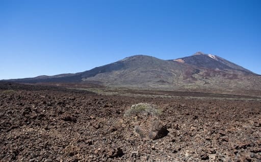
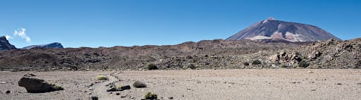
Teide-Pico Viejo Trail
The Teide-Pico Viejo Trail starts at La Rambleta (3,500 metres, Mirador de Pico Viejo) and ends at km 3.2 of the TF-38 road (Mirador de Las Narices del Teide).
It has a duration 4 to 6 hours, with a length of 9.6 km.
Its level of difficulty is extreme. And this one has a maximum drop of 1,450 metres downhill.
This route has connections with paths 12, 18, 23, 23, 28, 32 and 38.

This intrepid excursion allows the hiker to walk through the volcanic lava flows from medieval times that came out of the crater of Mount TeideYou can also fully enjoy the solemn crater of Pico Viejo with its 800 metres in diameter.
Telesforo Bravo Path
The Telesforo Bravo Trail starts from La Rambleta (3,550 metres) to Pico del Teide (3,718 metres).
Your duration is relatively short, taking a total of 40 minutes, thus covering a length of 653 metres.
The level of difficulty is high. It has a maximum ascent of 168 metres.
There is connections with paths 11 and 12.

It should be borne in mind that, for the safety of visitors and the preservation of the areaaccess from La Rambleta to the highest point of the Peak is not allowed, unless you have a special permit.
On the other hand, as this is a higher level trail, it is advisable to take precautionary measuresIt is advisable to walk at a leisurely pace and to stop frequently to rest.
It is really worth it, as once you are at the top you will be able to see some honourable panoramic views of Tenerife and other islands.
La Fortaleza Viewpoint Trail
La Fortaleza Viewpoint Trail starts from La Rambleta (3,550 metres) to the Mirador de La Fortaleza viewpoint.
Your duration is 25 minutes, so it is 664 metres long.
The level of difficulty of this route is medium. And it has a maximum gradient of 50 metres.
This route has connections with paths 7, 10 and 12.

It should be noted that, from the viewpoint you can contemplateThe view of the cliffs of La Fortaleza and a panoramic view of the east of the island, weather permitting.
Likewise, through this viewpoint, you will be able to appreciate the presence of the trade winds on the northern slopes of TenerifeThe clouds form a beautiful and eye-catching sea of clouds.
Pico Viejo Viewpoint Trail
The Pico Viejo Viewpoint Trail starts at La Rambleta (3,550 metres) and ends at the Pico Viejo viewpoint.
It covers a duration 30 minutes, making it 781 metres long.
The level of difficulty is medium. And it has a maximum height difference of 58 metres.
There is connections with paths 9, 10 and 11.

From this viewpointYou will have the opportunity to enjoy a magnificent view of the crater of Pico Viejo and the western sector of Tenerife.
On the other side, you will see the Lava Negras lava flow, and to the west you will see El Chinyero, the last volcanic eruption on the island of Chicharras.
At days of clarityis it is possible to observe the islands of La Gomera and El Hierro..
Samara Trail
The Samara Trail begins and ends at km 7.5 of the TF-38 road.
Your duration is approximately 2 hours and 45 minutes, thus covering a length of 4.6 km.
The level of difficulty is medium, so pay attention, as there is a steep section.
The route features connections with footpaths 32 and 38.

It should be noted that at the beginning of the tour you can climb to the summit of the Samara volcano.from which you will see incredible panoramic views of various volcanic cones, as well as Teide and Pico Viejo.
You will also be able to contemplate the beautiful Canarian pine forest.
Visit flora The following stand out in addition to pines, broom, broom, laburnum and rosebushes of summits.
With regard to the faunaare appreciated. kestrels and wood lizards; as well as frequent birds of the area, such as: canary warbler, great crested pipit, blue tit and reed warbler.
Alto de Guamaso Trail
The Alto de Guamaso Trail starts at Km 42.3 of the TF-24 road and ends at the Portillo crossroads.
Your duration is 1 hour and 30 minutes, covering a length of 3 km.
The difficulty is low. And it has a maximum height difference of 63 metres.
There is connections with the GR 131 path (former Royal Road of Chasna).

This comfortable and eye-catching route embodies a beautiful and breathtaking view of the Orotava Valley and the sea of clouds.
It is also a good place to observe the transition from Canary Island pine forest to high mountain scrubland.
Alto de Guajara Trail
The Alto de Guajara Trail The route starts at La Degollada de Guajara (footpath no. 5), and continues to La Degollada de Ucanca (footpath no. 31).
Your duration is 2 hours and 30 minutes, thus covering a length of 3.7 km.
The level of difficulty is high. And it has a maximum height difference of 352 metres.
The following are established connections with footpaths 5, 8, 31 and GR 131 (the old Camino Real de Chasna).

From this route, you will be able to contemplate the best panoramic view of the volcanoes Teide, Pico Viejo and Montaña BlancaThe Caldera de Las Cañadas is also well worth a visit.
It should be noted that, on clear days, the remaining islands of the Canary Archipelago can be seen..
Sanatorium
The Sanatorium Trail It starts at Km 43.3 of the TF-21 road and ends at the Siete Cañadas path (nº4).
Your duration is 1 hour and 45 minutes, covering a total length of 4.6 km.
This route has a level of difficulty low. It has a maximum height difference of 100 metres.
There is connections with footpaths 4, 19 and 39.
It is worth noting that the dome lavas of Montaña Blanca, with their different shapes, stand out on this path.
With regard to its floraThere is an abundance of broom, broomcorns, rosebushes, broomcorns and straw grasses.
It should be noted that in spring and summerthis is a good place to note the large number of insects that take advantage of the flowering period.
Igueque
The Igueque Trail starts at km 33.3 of the TF-24 road and ends at La Crucita (km 30 of the TF-24 road).
Your duration is 1 hour 20 minutes, thus covering a length of 2.7 km.
The level of difficulty is medium. And this route has a maximum difference in altitude of 258 metres.
The route presents a link with footpath 21.

This trail gives you the opportunity to contemplate the contrasts between the southern slopes of the islandwith the Güímar Valley as the protagonist, and the north facewith the beautiful Orotava Valley.
It should be noted that, canary pine trees are commonespecially at the end of the trail, at La Crucita.
Visit the Teide!
Don't miss the Experience Teide peak excursion: on foot or by cableway
Get to know the most visited national park in Europe and climb the highest peak in Spain. Exceed your limits on this excursion of ascent to Teide peak with permits.
If you want to live a unique and environmentally friendly experience, and also get to know the Teide National Park with a Senda guide, which has been declared a World Heritage Site by UNESCO, then this is the place for you. Unesco World Heritagebook your place for a guided visit to Teide with permits.
Chavao
The Chavao Trail starts at El Cruce de Boca Tauce (junction of roads TF-21 and TF-38) and ends at the Mirador de Las Narices del Teide (Km 3 of road TF-38).
Your duration is 1 hour 30 minutes, covering a length of 4.4 km.
This route has a level of difficulty low. And it has a maximum height difference of 42 metres.
The following are established connections with paths 9, 35 and 41 and PR-TF 70 Guía de Isora - Boca Tauce.
During this tourIn addition to the typical flora of the Cañadas (broom, wallflower, codewort, broom, etc.), it is worth noting that curious geological forms can be seen, such as the corded cushion lavas.
Majua
The Majua Trail starts at Km 43.3 of the TF-21 road and ends at the Parador de Las Cañadas.
Your duration is 1 hour 30 minutes, so its length is 4.1 km.
The difficulty is low. And this route has a maximum gradient of 146 metres.
There is a link established with trail 16.
This path descends comfortably from the foothills of Mount Teide to the Parador.located in the middle of the area known as Cañada Blanca.
It should be borne in mind that vegetation that dominates the landscape is the retamar. And, in addition to this species are frequent cod, straw grasses, roses and wolfberries.
Fasnia Volcano
The Fasnia Volcano Trail starts at Corral del Niño (Km 38 of the Tf-21 road) and ends at Cruce de Izaba (Km 37.5 of the Tf-21 road).
Your duration is 2 hours 30 minutes, so its length is 8.1 km.
The level of difficulty is low, and this route has a maximum gradient of 149 metres.
The route features connections with footpaths 21 and 37.

This path will allow you to enter the ancient volcanic cones with their beautiful and different colours.
It is necessary to take into account, the dense broom thickets The beehives are used by beekeepers to obtain the highly prized broom honey.
Other shrubs that are prevalent in the area are the cod, the straw grass and the summit rose bush.
At the fauna are frequent kestrels, Tawny Pipits, chiffchaffs and warblers.
Corral del Niño to La Yegua Blanca
The Corral del Niño to La Yegua Blanca Trail starts at El Corral del Niño (Km 38 of the TF-21 road), and ends at Yegua Blanca (Km 33.3 of the TF-24 road).
Your duration is 1 hour 40 minutes, making it 6.5 km long.
The level of difficulty is low. And this route has a maximum difference in altitude of 307 metres.
There is connections with footpaths 17, 20 and 34.

Through this tourThe route, which heads towards La Montaña Limón, you can easily see the group of volcanic cones present in the area and in the distance the silhouette of Mount Teide.
It is worth noting that from this route you will have the opportunity to contemplate the island of La Palma.
Lomo Hurtado
The Lomo Hurtado Trail The route starts at path nº1, in the area of Llano de Los Rastrojos and ends at path nº6, in the area of Montaña de Los Conejos.
Your duration is 1 hour 30 minutes (linear), with a length of 4.9 km.
The level of difficulty is low. And it has a maximum gradient of 425 metres.
The following are established connections with footpaths 1, 6, 7, 25 and 33.

This comfortable path connects the upper part of the Orotava Valley with Montaña Blanca..
It should be noted that most of the route runs on pumice stoneThe compacted area is easily accessible for walking.
Broom is the predominant plant species along the path, accompanied by some other species such as straw grass.
The Black Regatons
The Black Skidmarks Trail It starts at path nº3 Roques de García and ends at path nº9 Teide - Pico Viejo - TF 38.
Your duration is 4 hours (linear), so it is 5.2 km long.
The level of difficulty The competent path is high and steep, as the entire path is steep.
There is connections with footpaths 3 and 9.

It is important to know in advance that this trail requires a certain amount of physical preparationIt makes a steep ascent in the high mountains, reaching an altitude of 3,058 metres.
Also, you will have the opportunity to appreciate the various species of vegetation. The vegetation changes with each ascent, until you see only broom with very stunted branches at the top of the route.
And, it is worth mentioning, that it is a very interesting route for observe the various forms of lava that can emerge in volcanic eruptions.
Portillo Alto
The Portillo Alto Trail starts at El Caserío del Portillo Alto (Km 33.1 on the TF-21 road), and ends at footpath no. 1 in the Roque del Peral area.
Your duration is 35 minutes (linear), thus covering a length of 1.5 km.
The level of difficulty is low. And this route has a maximum height difference of 62 metres.
It is possible to establish connections with other routes, for example: paths 1 and 6.

It should be noted that in the course of the road beautiful panoramic views of the northern part of the Teide National Park.
Burnt Receipt
El Sendero Recibo Quemado The route starts on the La Orotava-Granadilla road (Km 29.6 of the TF-21 road) and ends at footpath no. 1, in the area of Llano de Los Rastrojos.
The duration of this is 45 minutes (linear), with a length of 2 km.
Its level of difficulty is low. And it has a maximum difference in altitude of 178 metres.
There is connections with footpaths 1 and 22.

It should be noted that This is a small section of one of the old paths leading up from the Orotava Valley to the summit pastures..
In turn, the the lower part of the route is through a Canarian pine forest.This gives way to the summit scrubland, through which you can see the escarpments of Cabezón and La Fortaleza, as well as El Teide and Montaña Blanca.
Ucanca
The Ucanca Trail The route starts from path no. 3, in the area of La Catedral and ends at the Mirador de Ucanca.
Your duration is 1 hour (linear), thus covering a length of 1.8 km.
The level of difficulty it refers to is low. And it has a maximum slope of 15 metres.
The following are established connections with footpaths 3 and 40.

This path is practically horizontal.
And it is worth noting that, along the route, the high escarpments of the Cumbres de Ucanca, as well as those of Teide and Pico Viejo, offer you an excellent unique and unparalleled vision.
Rajada Mountain
The Montaña Rajada Trail starts at path nº7, at the junction of the track with Montaña Rajada, and ends at path nº6, between Montaña de Los Conejos and Montaña de Los Tomillos.
Your duration is 45 minutes (linear), with a length of 2.1 km.
The level of difficulty is low. And this route has a maximum gradient of 98 metres.
There is connections with paths 6 and 7.
This route is a comfortable path with spectacular views of both volcanic domes.
And, it should be borne in mind that the entire terrain of the route is covered by pumice stone.The rock, from the violent plinian eruptions of Montaña Blanca.
Chafari
The Chafari Trail starts at the Boca Tauce crossroads (TF-21 and TF-38) and ends at path no. 9, in the area of Las Narices del Teide.
Your duration is 3 hours, which is why it covers a length of 6.5 km.
The level of difficulty is high, this is due to the fact that there are some steep sections. And it has a maximum ascent of 715 metres.
The following are established connections with footpaths 9 and 40.
It is useful to know that this is one of the trails up the slopes of Pico Viejo.The route starts on the TF 38 road just over a kilometre from Boca Tauce and most of its route runs along the dirt track known as "Los Chircheros", which climbs through a landscape of abundant broom, which colonises the lava flows that descend from the top of Pico Viejo.
Degollada del Cedro
The Degollada Trail del Cedro starts at path no. 1, in the area known as Cañada de Los Guancheros and ends at the edge of the Ladera de Tigaiga, on the northern boundary of the national park.
Your duration is 45 minutes, covering a length of 1.9 km.
The level of difficulty is low, however, it is worth mentioning that there is a steep section.
There is connections with footpaths 1 and 36.

In the course of the tour, you will be able to contemplate striking panoramic viewsThe most important of which are the slopes of Tigaiga, La Fortaleza and El Valle de La Orotava, as well as the interior of the Caldera and Teide itself.
Los Valles
The Los Valles Trail It starts at the Mirador de las Minas de San José (Km 37.5 of the TF-21 road), and ends at path no. 4, in the Risco Verde area.
Your duration is 1 hour 30 minutes (linear), with a length of 5 km.
The level of difficulty is low. And this route has a maximum gradient of 244 metres.
The following are established connections with footpaths 4 and 39.
It is worth noting that, along the route, you will have the option to to contemplate several of the most representative plant species of the Canary Islands high mountain scrubland..
Ucanca Heights
The Cumbres de Ucanca Trail starts at the footpath nº4, in the area of La Cañada del Capricho and ends at Lomo del Asiento, under the Sombrero de Chasna, at the southern limit of the Teide National Park.
Your duration is 3 hours 30 minutes (linear), so it is 7.7 km long.
The level of difficulty is high, as there is a steep section. And this route has a maximum gradient of 349 metres.
There is connections with paths 4 and 15.

It should be borne in mind that the entire length of this trail is a continuous viewpoint.The hotel offers wide and majestic panoramic views, both of the interior of La Caldera de Las Cañadas and of the southern slopes of the island.
Abeque
The Abeque Trail starts at the Mirador de Samara (Km 7.6 on the TF-38 road) and ends when you reach footpath no. 9.
Your duration is 1 hour 30 minutes (linear), with a length of 2.5 km.
The level of difficulty is low. And this route has a maximum gradient of 182 metres.
The following are established connections with footpaths 9 and 13.
It should be noted that this route is one of the ancient stretches that climbed to the summit of the island and crossed a landscape covered with volcanic materials.The volcanic cones that are located next to it.
In addition, this trail was formerly widely used by pastoralists and traders.
Y, you should know along the way, the wide views of the southern region and the nearby islands add to the scenic value of the route.
Black Mountain
The Black Mountain Trail starts from path nº1, in the western part of La Fortaleza and ends at path nº22, on the Llano de Las Brujas.
Your duration is 1 hour 15 minutes (linear), with a length of 3.1 km.
The level of difficulty is low. And this route has a maximum gradient of 149 metres.
There is connections with footpaths 1 and 22.

It should be borne in mind that it is the upper section of an old road.from the region of La Guancha, San Juan de La Rambla and Icod el Alto.
And, it should be noted, the dense broom in the upper sectionThe path runs along the trail, as well as the canary pine forest at the bottomwhich was affected by the forest fire in the summer of 2007 and is now in the recovery phase.
Lemon Mountain
The Lemon Mountain Trail It starts at the boundary of the National Park in the area of Montaña limón, and ends at the Arrastradero, near the old hut of José Ruiz de Izaña.
Your duration is 30 minutes (linear), with a length of 1.2 km.
The level of difficulty is low. And this route has a maximum height difference of 95 metres.
It establishes a link with footpath 21.

The trail is a short stretch of an old road linking the two great valleys (Güímar and La Orotava).
Boca Chavao
The Boca Chavao Trail The route starts from path no. 18, at the Boca de Chavao and ends at the boundary of the national park in the Iserse area.
Your duration is 30 minutes (linear), with a length of 724 metres.
The level of difficulty is low. And this route has a maximum gradient of 122 metres.
There is connections with footpaths 18 and the PR-TF70 Guía de Isora - Boca Tauce.

It should be noted that this short marked path was the main access route to the summit for the inhabitants of the Comarca de Isora.with several branches coming from the different hamlets.
Alto de La Fortaleza
The Alto de La Fortaleza Trail starts and ends at footpath no. 29, at Degollada del Cedro.
Your duration is 1 hour 15 minutes (circular), with a length of 2.7 km.
The level of difficulty is low, there is no danger. And this route has a maximum gradient of 75 metres.
It establishes link with footpath 29.

It should be noted that this route is part of a circular itinerary which acts as a crown on the Alto de La Fortaleza.
In the evening hours, you will have the opportunity to contemplate solemn sunsets behind the island of La Palma, which can be seen on the horizon.
It is worth mentioning vegetationIt is stunted in this area and brightly coloured in spring.
Cerrillar - Butcher's shop
The Cerrillar Trail It starts from path no. 2, on the Cerrillar ridge and ends at path no. 20, on the Montaña de la Carnicería.
Your duration is 1 hour 30 minutes (linear), with a length of 3 km.
The level of difficulty is low. And this route has a maximum height difference of 113 metres.
There is connections with footpaths 2, 8 and 20.
During the walk along this trail, we will have the opportunity to observe, if the sea of clouds allows it, the breathtaking landscapes of the Orotava ValleyWe walk among the volcanoes of the Caramujo sector.
Likewise, this trail will allow you to link the Portillo area with the Izaña area, without the need to travel along the asphalted road.
In this way, you will be able to enjoy a more enriching experience of the summit and in full contact with the environment.
Black Caves
The Cuevas Negras Trail starts at path no. 9 and ends at path no. 13.
Your duration is 1 hour 30 minutes (linear), with a length of 2.2 km.
The level of difficulty is medium. And this route has a maximum difference in altitude of 124 metres.
The following are established connections with footpaths 9 and 13.
It is worth mentioning that this magical route runs through natural sceneryalmost without vegetation.
In the midst of this landscape, you can perceive the Chahorra Caves or Black Caves.
Cable Car - Montaña Blanca - San José Mines
The Cable Car Trail starts from path no. 16 (which starts in front of the cable car base), and ends at Las Minas de San José.
Your duration is 2 hours 45 minutes (linear), with a length of 6.8 km.
The level of difficulty is medium. And this route has a maximum height difference of 128 metres.
There is connections with paths 16 and 30.

It is worth appreciating the energy savings you will avoid by taking the cable car section (1 hour 30 minutes long), as you no longer have to walk on the road to get from one place to another.
And then you will take the section Montaña Blanca (1 hour and 15 minutes long).
Warning: extremely dangerous to walk on the road, therefore, this trail is ideal to go from the cable car to Montaña Blanca or vice versa..
Llano de Ucanca - Boca Tauce
The Llano de Ucanca Trail starts at the Mirador del Llano de Ucanca and ends at Boca Tauce.
Your duration is 1 hour 30 minutes (linear), with a length of 4.8 km.
The level of difficulty is low. And this route has a maximum gradient of 30 metres.
The following are established connections with paths 26 and 28.

It should be noted that, this route crosses large lava plains and lava fronts..
It is also worth noting that, during this comfortable route, you will have the opportunity to appreciate the plains among the giants.
Erques Ravine
The Erques Ravine Trail starts at the Juan Évora Ethnographic Museum and ends at the Barranco de Erques ravine.
Your duration is 30 minutes (linear), with a length of 1 km.
The level of difficulty is medium. And this route has a maximum difference in altitude of 139 metres.
There is a link with trail 18.

As far as this majestic route is concerned, it should be noted that is short, but quite attractive, with a long and deep ravine..
In addition, it is recommended not to use it during the rainy season.It has some steep slopes.
If you are a lover of trails and nature, it is essential that you take the route of the senses in Anaga have a look!
Add comment